

iKey UAV/drone capability
_edited.jpg)
_edited.jpg)
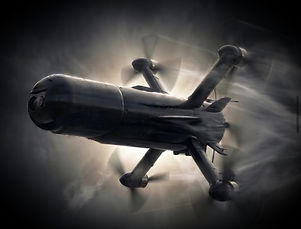
For over a decade, iKey Solutions has been actively involved in the drone sector, combining operational field experience with the development, testing, and evaluation of advanced drone systems. As demonstrated in the link below, our expertise is built on real-world operational requirements and hands-on experience.
Together with our strategic partner, SafeTech Sentinel, iKey Solutions provides access to advanced defense technologies and counter-UAS (Unmanned Aircraft Systems) capabilities. SafeTech Sentinel is a Norwegian defense technology company with an operational presence in Ukraine, specializing in advanced military technologies, interceptor drone systems, aerial defense solutions, integrated IRS systems, and counter-drone capabilities.
Drawing on extensive real-world experience gained in modern conflict environments, our team develops innovative defense technologies designed to address evolving battlefield challenges. Our expertise includes interceptor drone systems, aerial defense capabilities, advanced surveillance technologies, and integrated counter-drone solutions.
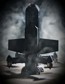
Ukraine's extensive experience in countering drone warfare has enabled our team to refine and validate these technologies under demanding operational conditions. This practical experience has contributed to the development of highly effective solutions capable of detecting, tracking, and intercepting a wide range of unmanned aerial threats.
Our systems incorporate advanced radar detection, AI-assisted targeting, and rapid-response capabilities, providing military, governmental, and security organizations with reliable tools to protect critical infrastructure, personnel, and strategic assets.
Through continuous innovation and close cooperation with defense and security stakeholders, our team remains committed to delivering proven technologies that enhance operational effectiveness, force protection, and national security.
As part of the iKey Solutions strategic partner network, SafeTech Sentinel contributes cutting-edge defense technologies, operational expertise, and specialized capabilities to support clients seeking advanced security and defense solutions.